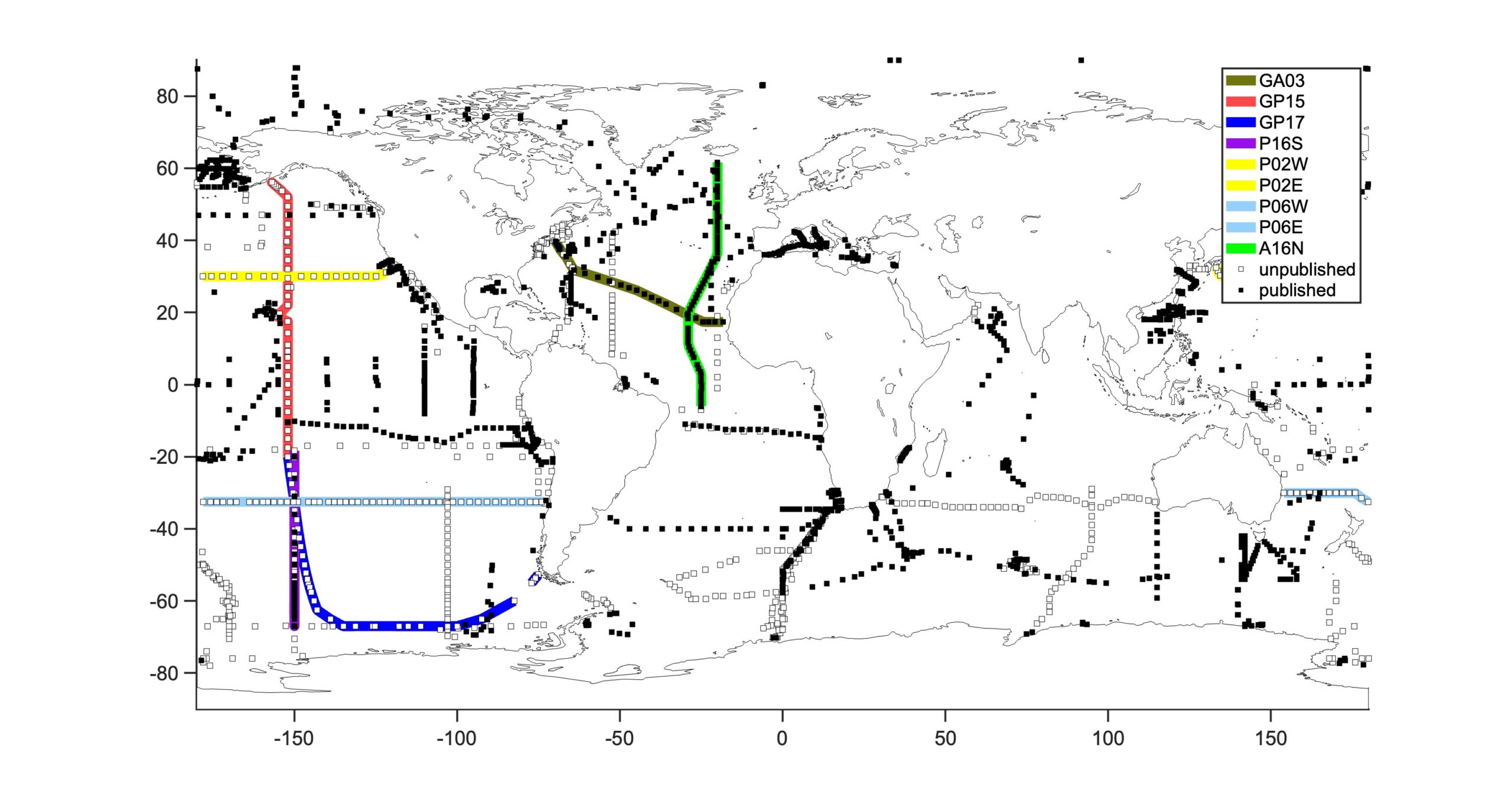
This map shows the distribution of all published (filled squares) and unpublished (open squares) nitrogen and oxygen isotope data from across the global ocean. Each symbol indicates the location of a depth profile. At present there are 1421 unique locations of nitrate isotope data. Click on downward arrows to be directed to webpages where data for that specific cruise can be downloaded. Click on photo icons to see depth sections of the data for that specific cruise.
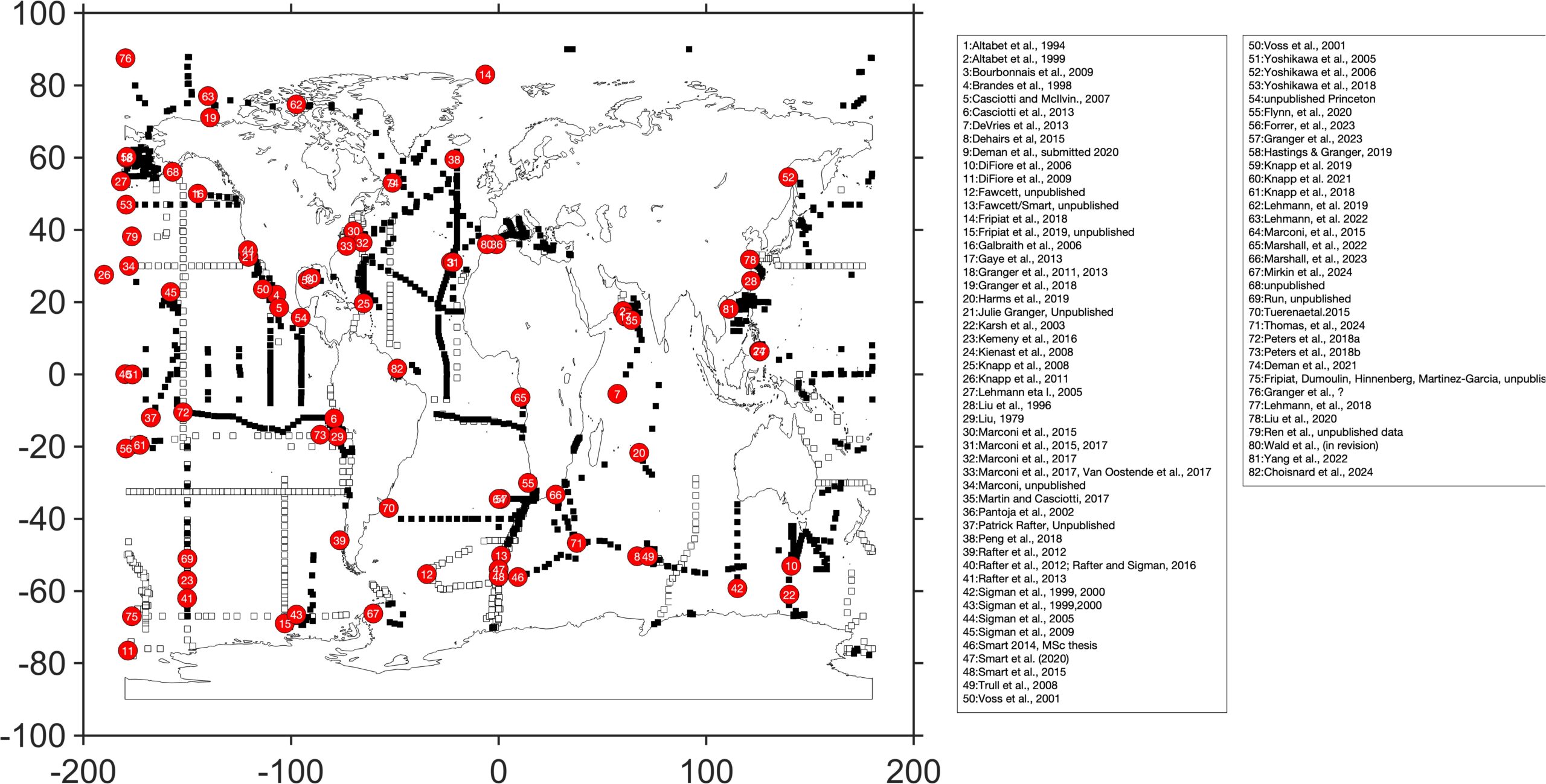
References for nitrogen and oxygen nitrate isotope data that are published (filled squares). Open squares indicate unpublished data.