
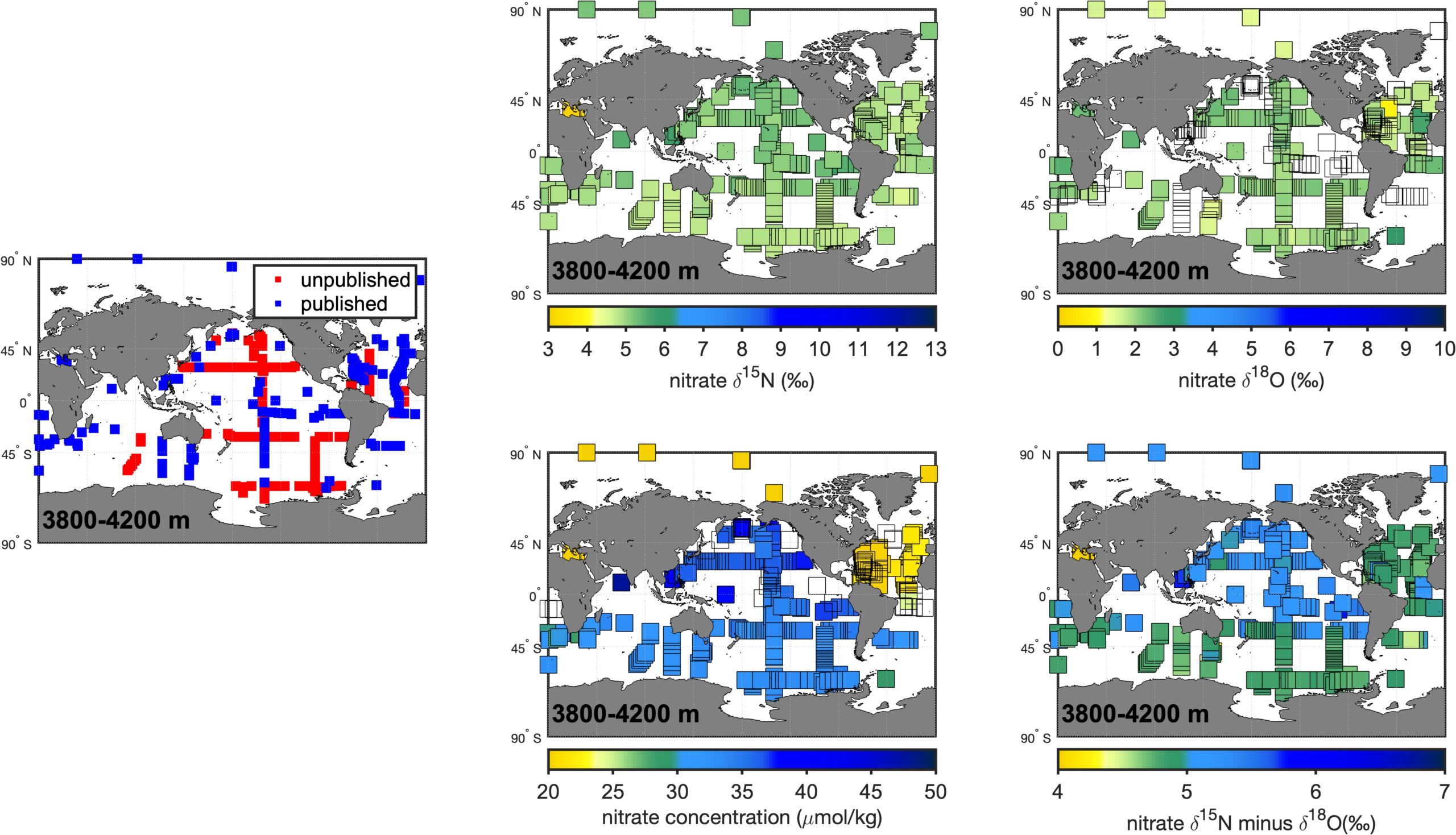
Maps showing data distribution (left), nitrate δ15N (upper left; ‰), nitrate δ18O (upper right; ‰), nitrate concentration (lower left; μM) and nitrate δ15N minus nitrate δ18O (lower right; ‰) for a given depth range indicated on the map. Symbol color on the upper and lower panels indicates the average value for all measurements within each depth bin. Empty symbols indicate missing data.
The five depth bins broadly correspond to key water masses in the global ocean, with 0-80 m reflecting surface waters, 150-300 m reflecting thermocline waters, 900-1300 m reflecting intermediate waters, 2800-3200 m reflecting deep waters, and 3800-4200 m reflecting abyssal waters.